


BlackBox UAV
BlackBox NOVA Surveyor VTOL
BlackBox NOVA Surveyor VTOL
SKU:BBUAV-NOVAS-RTK-1
Backorder
Couldn't load pickup availability

BLACKBOX NOVA SURVEYOR
Long Endurance. Massive Coverage. Precision Data.
The BlackBox Nova Surveyor is a professional long-endurance VTOL mapping platform designed for large-area aerial surveying, mapping and data collection.
Combining the proven Nova VTOL platform with a 61 MP full-frame mapping camera, precision Emlid RTK positioning, and a dedicated Emlid RS2+ local base station, the Nova Surveyor delivers high-resolution aerial data over exceptionally large areas — without relying on cellular networks or NTRIP correction services.
With up to 3 hours of survey endurance and an 18 m/s cruise speed, the Nova Surveyor is built to cover serious ground in a single mission.
KEY FEATURES
3-HOUR SURVEY ENDURANCE
Up to 3 hours of endurance provides exceptional coverage for large-area mapping missions while reducing the number of flights required.
61 MP FULL-FRAME IMAGING
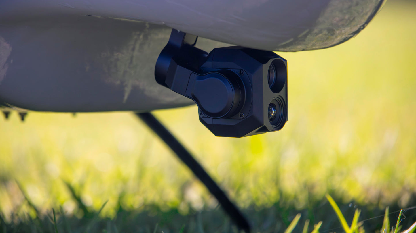
The ADTi 61PRO provides 61 MP full-frame imagery at 9504 × 6336 resolution, delivering high-resolution data suitable for professional photogrammetry and mapping workflows.
SONY FE 28MM F2 LENS
The compact full-frame 28 mm lens provides a wide mapping footprint while maintaining excellent ground resolution.
PRECISION RTK POSITIONING
An integrated Emlid Reach M2 provides RTK positioning to the aircraft, allowing the Nova to operate with a high-precision GNSS solution during flight.
LOCAL RTK BASE STATION
The package includes an Emlid Reach RS2+ base station, allowing corrections to be transmitted directly to the aircraft without dependence on cellular coverage or NTRIP services.
Simply establish the base station using the customer's existing survey tripod, connect the system and fly.
PPK FALLBACK
The Reach M2 simultaneously records the GNSS and camera event data required for post-processing.
PPK provides an independent fallback and post-flight positioning workflow should RTK corrections be interrupted during a mission.
BUILT FOR DATA
The Nova Surveyor is designed around the complete mapping workflow — from image acquisition and precise positioning to professional photogrammetric processing.

MAPPING PERFORMANCE
Reference configuration: 1,000 ft AGL
-
Survey cruise speed: 18 m/s
-
Survey endurance: up to 3 hours
-
Camera: 61 MP full-frame
-
Lens: 28 mm
-
Ground sampling distance: ~4.1 cm/pixel
-
Image footprint: ~389 × 259 m
-
Sidelap: 65%
-
Frontlap: 75%
-
Theoretical coverage: ~880 ha/hour
-
Theoretical 3-hour coverage: ~2,640 ha
-
Practical planning coverage: ~2,100 ha per flight
-
Flight distance: ~194 km
-
Approximate images per 3-hour mission: ~3,000
Coverage figures are theoretical/planning estimates and depend on altitude, terrain, wind, mission design, turns, airspace restrictions, take-off and landing requirements, operational reserves and other environmental factors.

RESOLUTION VS COVERAGE
The Nova Surveyor can be configured for different survey requirements by adjusting operating altitude.
| Altitude | Approx. GSD | Approx. Coverage / Hour | 3-Hour Theoretical Coverage |
|---|---|---|---|
| 500 ft | 2.05 cm/px | 440 ha/h | 1,320 ha |
| 750 ft | 3.07 cm/px | 660 ha/h | 1,980 ha |
| 1,000 ft | 4.09 cm/px | 880 ha/h | 2,640 ha |
| 1,250 ft | 5.12 cm/px | 1,100 ha/h | 3,300 ha |
| 1,500 ft | 6.14 cm/px | 1,320 ha/h | 3,960 ha |
Actual operating altitude is subject to applicable aviation regulations, mission requirements and terrain.

RTK + PPK
The Nova Surveyor uses a dual-workflow positioning architecture.
RTK — PRIMARY
The Reach M2 provides real-time RTK positioning to the Nova's flight controller while the Reach RS2+ base station provides local corrections.
This allows the aircraft to operate without relying on cellular networks or subscription-based NTRIP correction services.
PPK — BACKUP
The Reach M2 records raw GNSS observations and precise camera event timing during the mission.
If required, the aircraft and base-station data can subsequently be processed using a PPK workflow to determine highly accurate image positions.
This provides an additional layer of redundancy for professional mapping operations.
COMPLETE SURVEY PACKAGE
The Nova Surveyor includes:
-
BlackBox Nova VTOL
-
ADTi 61PRO 61 MP full-frame mapping camera
-
Sony FE 28mm F2 lens
-
Emlid Reach M2 RTK/PPK receiver
-
Multi-band GNSS antenna
-
Emlid Reach RS3 RTK base station
-
Base-station GNSS antenna
-
RTK communication equipment
-
Camera hot-shoe/event interface
-
Integrated aircraft power systems
-
Dedicated camera mounting system
-
Camera trigger and event wiring
-
Required aircraft integration hardware
-
2 × 256 GB high-speed SDXC memory cards
Standard Nova equipment also included:
-
Pixhawk 6 flight controller
-
Skydroid H16 ground control system
-
2 × flight batteries
-
Battery charger
Survey tripod, processing computer and photogrammetry software are not included.
The RS3 is designed to be used with a standard survey tripod, allowing operators to use their existing survey equipment.
PROFESSIONAL APPLICATIONS
The Nova Surveyor is suited to a wide range of large-area aerial data applications:
Surveying & Mapping
-
Orthomosaic generation
-
Topographic surveys
-
DSM / DTM generation
-
3D reconstruction
-
Contour mapping
-
Terrain modelling
Mining & Construction
-
Stockpile measurement
-
Quarry mapping
-
Progress monitoring
-
Site surveys
-
Earthworks measurement
-
Infrastructure documentation
Agriculture & Forestry
-
Large-area crop mapping
-
Plantation surveys
-
Vegetation monitoring
-
Land-use mapping
-
Forestry inventory
Environmental & Conservation
-
Habitat mapping
-
Environmental monitoring
-
Coastal surveys
-
Conservation mapping
-
Large-area change detection
Infrastructure
-
Corridor mapping
-
Roads and rail
-
Powerline corridors
-
Pipelines
-
Large-scale asset documentation
WHY NOVA SURVEYOR?
MASSIVE COVERAGE
Cover thousands of hectares without repeatedly landing and relaunching a multirotor.
HIGH-RESOLUTION DATA
61 MP full-frame imagery provides the resolution required for demanding professional mapping applications.
INDEPENDENT RTK
A dedicated local RTK base station means your mapping operation doesn't depend on cellular coverage.
RTK + PPK
Real-time positioning combined with post-processing capability provides redundancy and flexibility.
VTOL OPERATION
Vertical take-off and landing eliminates the need for a runway while retaining the efficiency of a fixed-wing aircraft.
BUILT FOR THE REAL WORLD
The Nova is designed as a practical, reliable workhorse for operators who need to collect large amounts of useful data — not simply fly an aircraft.
TECHNICAL SPECIFICATIONS
| Specification | Nova Surveyor |
|---|---|
| Aircraft | BlackBox Nova VTOL |
| Cruise Speed | 18 m/s |
| Maximum Survey Endurance | Up to 3 hours |
| Mapping Camera | ADTi 61PRO |
| Sensor | 61 MP Full-Frame CMOS |
| Image Resolution | 9504 × 6336 |
| Lens | Sony FE 28mm F2 |
| Positioning | Emlid Reach M2 RTK / PPK |
| Base Station | Emlid Reach RS3 |
| Flight Controller | Pixhawk 6 / ArduPilot |
| GCS | Skydroid H16 |
| Typical GSD @ 1,000 ft | ~4.1 cm/px |
| Theoretical Coverage @ 1,000 ft | ~880 ha/h |
| Practical Planning Coverage | ~2,100 ha / 3-hour flight |
| RTK Correction Method | Local wireless base station |
| PPK | Supported |
| Camera Storage | 2 × 256 GB SDXC |

DATA, NOT JUST IMAGES
The Nova Surveyor is designed around one simple principle:
The aircraft is only the tool. The DATA is the product.
From high-resolution full-frame imagery to RTK positioning and PPK capability, every part of the system is selected to maximise the quality, quantity and reliability of the data collected.
PACKAGE CONTENTS
Everything You Need to Get NOVA in the Air
NOVA is supplied as a complete operational system, with the aircraft and essential equipment required for deployment.
NOVA AIRCRAFT
The complete NOVA VTOL airframe, including its integrated propulsion, VTOL system and flight electronics.
H16 PRO CONTROLLER
Professional ground control unit for operating the aircraft and managing missions.
BATTERY SYSTEM
2x Flight batteries and associated equipment required to power the aircraft.
CHARGING EQUIPMENT
Charging equipment for preparing the system for operation.
RTK System
The Nova Surveyor has the EMLID Reach RTK System included with an RS3 Base.
ADTi 61MP Survey Grade Camera
Included is the ADTi 61MP Pro Survey-Specific Camera with a Sony EF28mm F2 Lens.
PROPELLERS
Flight and VTOL propulsion propellers as required for the NOVA configuration.
ACCESSORIES & HARDWARE
Essential cables, connectors, mounting hardware and operational accessories.
OPTIONAL TRANSPORT CASE
A dedicated transport case is available as an optional addition for protecting and transporting the NOVA system.
NOVA Specifications
| Specification | NOVA |
|---|---|
| Aircraft Type | Fixed-Wing VTOL UAV |
| Wingspan | 2,180 mm |
| Length | 1,140 mm |
| MTOW | 7.5 kg |
| Payload | 1 kg |
| Endurance | 2–3 hrs with 500 g payload |
| Maximum Speed | 25 m/s |
| Cruise Speed | 17–22 m/s |
| Flight Altitude | 3,000 m |
| Wind Resistance | Level 5 |
| Construction |
EPO / Carbon Fibre / Aluminium / Engineering Plastics |
CONTROL SYSTEM
| Specification | |
|---|---|
| Controller | H16 Pro |
| Frequency | 2.400–2.483 GHz |
| Control Range | 10–30 km |
| RF Power | 20 dBm CE / 23 dBm FCC |
| Software | QGroundControl |
| Connectivity | Wi-Fi / RJ45 / USB / USB-C |
BLACKBOX UAV
Proudly designed and manufactured in South Africa.
World-class performance.
No-nonsense reliability.
Simplicity is KEY.
Carrying your DATA.
Mapping accuracy is dependent on GNSS solution quality, camera calibration, lens characteristics, flight planning, terrain, processing methodology and the use of appropriate checkpoints/GCPs. Stated coverage figures are theoretical/planning estimates and are not guaranteed operational results.


Backorder T&Cs

Backorder & Custom Build Terms & Conditions
BlackBox UAV – Backorders, Deposits, Assembly, Testing & Shipping
Due to the specialised nature of our UAV systems and the number of components sourced from suppliers around the world, certain products may be supplied on a backorder or build-to-order basis.
By placing a backorder or custom UAV order with BlackBox UAV, the customer acknowledges and agrees to the following terms.
1. Lead Times
Estimated lead times for backordered or build-to-order UAVs are generally 5–10 weeks from receipt of the required deposit.
Lead times are estimates and are dependent on the availability and delivery of components required to complete the UAV.
A UAV may consist of components sourced from multiple suppliers and countries, with each supplier having their own manufacturing and shipping lead times. As a result, delays from one or more suppliers may affect the overall completion time of the UAV.
The 5–10 week lead time is therefore an estimated timeframe and does not constitute a guaranteed delivery date.
BlackBox UAV will make reasonable efforts to keep the customer informed of the progress of their order.
Supply Issues
If a significant supply issue, component shortage, discontinued component, shipping delay or other unforeseen circumstance affects the estimated lead time, BlackBox UAV will contact the customer as soon as reasonably possible to discuss the available options.
Depending on the circumstances, these options may include:
- Waiting for the required component to become available;
- Substituting a component with an equivalent or suitable alternative, subject to customer approval;
- Adjusting the configuration or specification of the UAV; or
- Other mutually agreed arrangements.
2. Deposit & Payment
A 75% deposit is required before any parts are ordered or assembly work commences.
The deposit is non-refundable once parts have been ordered or work has commenced, as components may be specifically procured for the customer's UAV and may not be suitable for resale.
The remaining 25% balance is payable in full before the completed UAV can be shipped or released to the customer.
BlackBox UAV will not ship or release the completed UAV until payment has been received in full and cleared.
3. Assembly & Quality Control
Each UAV is assembled and configured according to the agreed specification.
Before shipment, every completed UAV will undergo Factory Acceptance Testing (FAT), including flight testing where appropriate, to verify the aircraft's functionality and ensure that it meets BlackBox UAV's quality-control requirements.
FAT may include, but is not limited to:
- Flight control and stability checks;
- VTOL system testing;
- Motor and propulsion checks;
- Radio and telemetry checks;
- Navigation and flight-controller checks;
- Power system checks;
- Payload/interface checks where applicable; and
- General aircraft functionality and operational checks.
The purpose of FAT is to identify and resolve manufacturing, assembly or configuration issues before the UAV leaves BlackBox UAV.
4. Shipping
South Africa
Shipping within South Africa will be handled through local courier services.
Shipping costs will be quoted separately where applicable and are payable by the customer unless otherwise agreed in writing.
BlackBox UAV will take reasonable care to package the UAV appropriately for transportation. Once the shipment has been handed over to the courier, transportation and delivery are subject to the courier's terms, conditions and delivery schedules.
International Orders
International shipping must either:
- Be arranged through DHL, where available and agreed with the customer; or
- Be arranged by the customer through their nominated freight or courier provider.
International customers are responsible for any applicable:
- Import duties;
- Customs charges;
- Taxes;
- Import permits or approvals;
- Aviation or regulatory requirements; and
- Other costs associated with importing the UAV into the destination country.
BlackBox UAV is not responsible for delays caused by international customs clearance, import regulations or authorities in the destination country.
5. Customer-Supplied Shipping Arrangements
Where the customer elects to arrange their own shipping, BlackBox UAV will make the completed UAV available for collection or handover once:
- The UAV has successfully completed the required FAT;
- Full payment has been received; and
- The customer's nominated courier or freight provider is ready to collect the shipment.
Responsibility for transportation will transfer to the customer or their nominated carrier once the UAV has been handed over.
6. Changes to the Order
Because UAVs may contain components specifically procured for a customer's order, changes to the configuration after the deposit has been paid may result in additional costs or delays.
Any requested changes will be assessed by BlackBox UAV and, where applicable, additional costs will be communicated to the customer for approval before the changes are implemented.
7. Estimated Delivery Dates
Any delivery or completion date provided by BlackBox UAV is an estimated date only unless a specific guaranteed delivery date has been expressly agreed to in writing.
BlackBox UAV will make reasonable efforts to complete orders within the estimated lead time, but cannot be held responsible for delays caused by circumstances outside of its reasonable control, including supplier delays, component shortages, international shipping delays, customs delays or other supply-chain disruptions.
8. Acceptance of Terms
By placing a backorder, paying the required deposit, or authorising BlackBox UAV to commence procurement or assembly, the customer confirms that they have read, understood and accepted these Backorder & Custom Build Terms & Conditions.
These terms should be read together with the BlackBox UAV General Terms & Conditions and any specific quotation, sales agreement or order documentation provided to the customer.
BlackBox UAV reserves the right to update these terms from time to time. The terms applicable to an order will be those accepted by the customer at the time the order is placed.